Radar image above:
NWS Fort Worth @NWSFortWorth 5:49 PM - This tornado is moving east at 30 MPH and will cross I-35 near Salado!! Radar indicates VERY STRONG rotation!! Seek shelter NOW!!! #ctxwx #txwx
5:52pm: Potentially violent tornado west of Salado is ongoing now! This is a life threatening situation! If you are in this area: Get in a bathtub in an interior room with no windows, put pillows or a mattress over your self. Bicycle helmets are good too! #ctxwx
(AP) Nearly two dozen people were injured when tornadoes swept through central Texas as part of a storm system that was expected to spawn more twisters and damaging winds Wednesday.
The storms caused widespread damage Tuesday in Salado, about 50 miles (80 kilometers) north of Austin. Bell County Judge David Blackburn said 23 people were injured, one of them critically. Twelve of the injured were taken to hospitals, Blackburn said.
“There’s not much left,” Blackburn said at a news conference Tuesday night. “Large trees are uprooted and overturned and stripped. Buildings really reduced to rubble. ... Power lines, power poles, are scattered all over the place. It’s pretty devastating.”
Photos on social media showed grapefruit-size hail associated with that storm.
Tornadoes were also spotted Tuesday in Iowa, but there were no reports of serious injuries. In Lincoln, Nebraska, powerful wind gusts knocked down tree limbs and caused some roof damage.
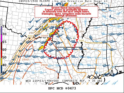
More tornadoes were in the forecast Wednesday for parts of the mid-South and in the Mississippi River Valley, the Storm Prediction Center said.
Hurricane-force winds, intense tornadoes and large hail were possible in Arkansas, Illinois, Tennessee, Missouri, Kentucky, Mississippi, Indiana, Louisiana and Alabama, forecasters said. Little Rock, Arkansas, and Memphis, Tennessee, were among the cities that could see the worst weather Wednesday, the Storm Prediction Center said.
Elsewhere, the North Dakota Capitol, schools, government offices and interstates remained closed Wednesday as a blizzard continued to bear down on the state.
A blizzard warning issued by the National Weather Service remained in effect through Thursday for most of western and central North Dakota where up to 2 feet (60 centimeters) of snow was expected.