
First alerts sent to Florida residents notifying them of hurricane and storm surge warnings
The first alerts notifying residents of Pinellas, Manatee, Pasco, Charlotte, Citrus and Hillsborough counties in Florida of a hurricane warning and storm surge warning went out via email, text message and phone call beginning at about 5:10 p.m. EDT, according to messages received by The Associated Press.
The hurricane warning said the impacts of Milton could be “devastating to catastrophic.”
The alerts warned that sturdy buildings could suffer complete roof and wall failures, and that damage could make some areas "uninhabitable for weeks or months.”
Key Messages:
1. Damaging hurricane-force winds and a life-threatening storm surge with destructive waves are expected across portions of the northern coast of the Yucatan Peninsula through tonight.
2. Milton is expected to grow in size and remain an extremely dangerous hurricane when it approaches the west coast of Florida on Wednesday. A large area of destructive storm surge will occur along parts of the west coast of Florida on Wednesday. This is an extremely life-threatening situation and residents in those areas should follow advice given by local officials and evacuate immediately if told to do so.
3. Potentially devastating hurricane-force winds are expected along portions of the west coast of Florida where a Hurricane Warning is in effect. Milton is forecast to remain a hurricane as it crosses the Florida Peninsula and life-threatening hurricane-force winds, especially in gusts, are expected to spread inland across a portion of the entire Florida Peninsula. Preparations to protect life and property in the warning areas should be complete by Tuesday night since tropical storm conditions are expected to begin within this area early Wednesday.
4. Areas of heavy rainfall will continue to impact portions of Florida well ahead of Milton, with heavy rainfall more directly related to the system expected Tuesday night through early Thursday. This rainfall brings the risk of considerable flash, urban, and areal flooding, along with moderate to major river flooding. Flooding will be exacerbated in areas where coastal and inland flooding combine to increase the overall threat. - National Hurricane Center
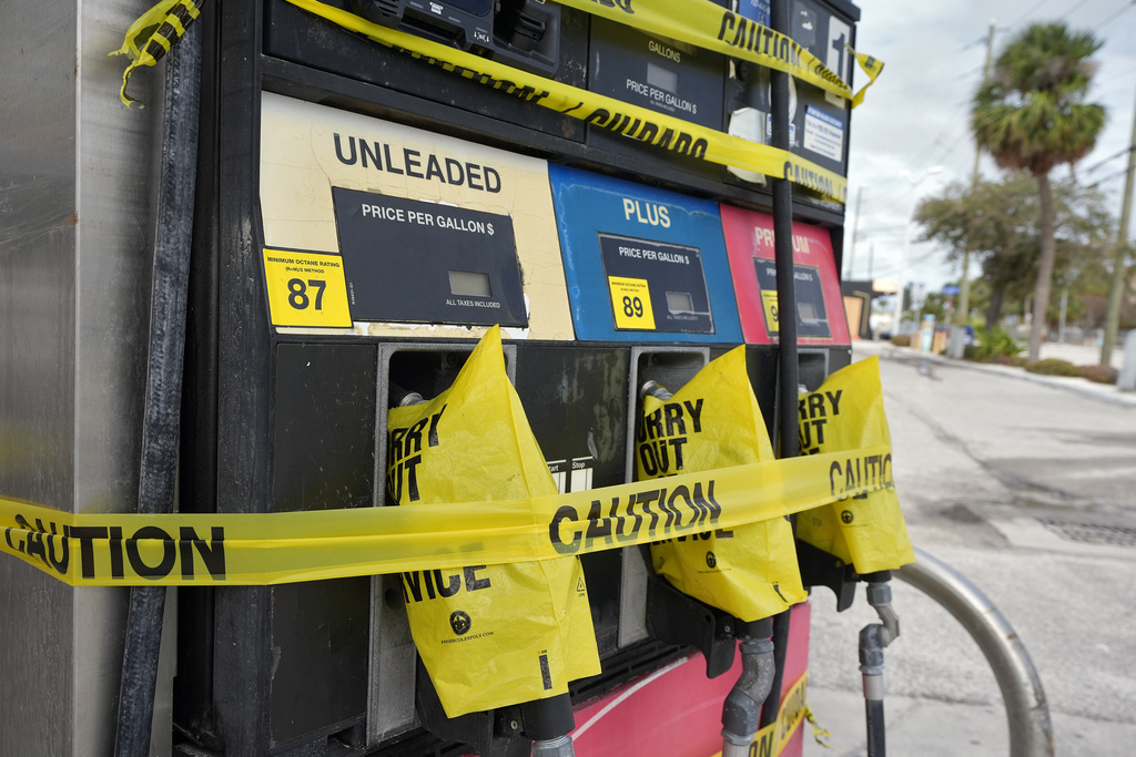
Some stuck without gasoline, but help coming
St. Petersburg officials warn storm surge from Milton could be greater than Helene's
ST. PETERSBURG, Fla. — In St. Petersburg, officials warned residents still cleaning up after Helene’s storm surge that flooding could be twice as great during Milton.
“Our community now faces an ever more daunting challenge,” said Mayor Ken Welch. “This is a powerful storm. More powerful than Helene with more potential storm surge.”
If the city takes a direct hit, the rebuilding of electric and water services could take a long time, he said.
“But the most important thing at this point is to save lives,” Welch said. “Please heed all evacuation orders. This is an incredibly powerful storm.”
Airports near Tampa to ground flights Tuesday
TAMPA, Fla. — Tampa International Airport said it will stop flights at 9 a.m. Tuesday, before Hurricane Milton is expected to make landfall. The airport posted on X that it is not a shelter for people or their cars.
St. Pete-Clearwater International Airport said it is in a mandatory evacuation zone and will close after the last flight leaves on Tuesday.
The imminent shutdowns made the few flights out of the storm’s path expensive. By late Monday afternoon, American Airlines’ website showed only a few seats left on Monday night departures from Tampa. Most flights to Atlanta were priced at more than $1,000 for a one-way ticket. Delta Air Lines showed nothing available.

Storm surge and hurricane warnings issued for most of Florida's west coast
MIAMI — The U.S. National Hurricane Center has issued storm surge warnings for almost the entirety of Florida's west coast, from Flamingo at the state's southern tip to the Suwanee River, which flows into the Gulf of Mexico about halfway between Tallahassee and Tampa.
The majority of that area was also under a hurricane warning. The hurricane center also issued storm surge watches on the U.S. East Coast including much of Florida up to parts of South Carolina.
Hurricane Milton's sustained wind speeds increased to 180 mph (290 kph) Monday afternoon, the hurricane center said. The Category 5 storm, located 80 miles (125 kilometers) off the coast of Progreso, Mexico, was moving east at 10 mph (17 kph).
“Milton poses an extremely serious threat to Florida and residents are urged to follow the orders of local officials,” the hurricane center said in their latest storm advisory.
Florida governor warns Milton is stronger than previously forecast
TALLAHASSEE, Fla. — Florida Gov. Ron DeSantis pointed out while briefing reporters Monday afternoon that the hurricane is already far stronger than what was predicted two days ago.
“This is a ferocious hurricane,” DeSantis said.
DeSantis cautioned that while the storm is expected to weaken by the time it reaches Florida, residents shouldn't bank on it, and said Milton will cause destruction regardless.
“At the strength it is now, this is a really, really strong storm. The effects of that, not just from the storm surge but from wind damage and debris, will be really, really significant,” DeSantis said. “This is not a storm you want to take a risk on.”
Those who plan to stay in Tampa prepare for Milton’s expected arrival
TAMPA, Fla. — The streets were quiet Monday afternoon in Tampa’s Channel District, home to sleek high rises, coffee shops and the state’s largest seaport — Port Tampa Bay. A Margaritaville-themed cruise ship set sail one day early from the port, revelers leaving behind this vulnerable stretch of Florida’s Gulf Coast to the sounds of Soca music.
Residents walked their dogs while Amazon delivery workers dropped off their packages ahead of Hurricane Milton’s expected arrival midweek.
Spence Clark and his 9-year-old chihuahua terrier mix Tiny got some fresh air before the rain was forecast to move in. His fiancé is an EMT and has to stay in town to respond to the storm, so Clark and Tiny plan to hunker down there in their fourth-floor apartment. He said residents seem to be taking this storm more seriously after the damage dealt by Hurricane Helene not even two weeks ago.
“I feel like a lot more people are evacuating as well. Like, I know a lot of my friends have left or they are planning to,” Clark said. “It’s more sensitive now that we have gone through something traumatic.”
The couple has stocked up on snacks and water and parked their cars in an elevated garage ahead of the storm. Clark said he’s not too worried; he joked that it may be harder to keep Tiny fed than he and his fiancé. The dog eats a special kind of food that’s supposed to stay frozen, not shelf-stable kibble.
“I feel like the most thing we’re worried about is his dog food,” Clark said with a laugh. “Gotta prepare for him more than us.”
Traffic crawls on I-75 as people evacuate Florida
WILDWOOD, Fla. — Interstate 75 northbound was bumper to bumper and moving about 6 to 7 mph (10 to 11 kph) Monday afternoon as Floridians and visitors to the state attempted to flee Hurricane Milton.
The traffic snarl stretched for miles north of Tampa and in the Wildwood area, where Florida’s Turnpike pours into I-75.
Earlier Monday, the state opened the left shoulder to motorists in an effort to expedite the evacuation route.