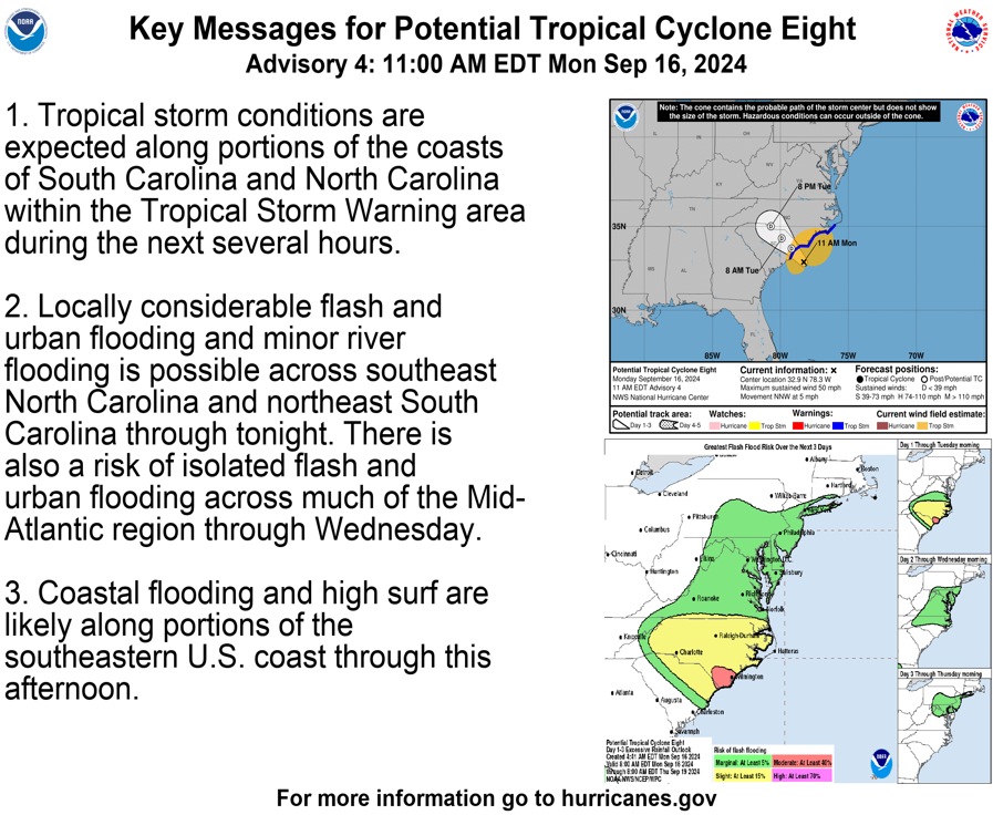
MIAMI (AP) — Tropical storm conditions were expected along a stretch of the southeastern U.S. coast with a system bringing gusty winds, heavy rain and potential flooding, forecasters said Monday.
The storm system was expected to reach the South Carolina coast Monday afternoon and then move inland across the Carolinas from Monday night through Wednesday, the U.S. National Hurricane Center said. Strong winds were approaching the coast Monday morning and were expected to spread onshore.
The system didn't have an official name yet, and forecasters weren't sure if Potential Tropical Cyclone No. 8 would ever organize enough to be named Helene.
But no matter its classification, the storm prompted school closings, including Coastal Carolina University, and flooded the streets south of Wilmington, North Carolina, with more than a foot (30 centimeters) of rain while nearby Wrightsville Beach had a wind gust of 65 mph (105 kph).
A tropical storm warning was in effect from the South Santee River north of Charleston, South Carolina, northward to Ocracoke Inlet, near the southernmost extreme of North Carolina's Outer Banks.