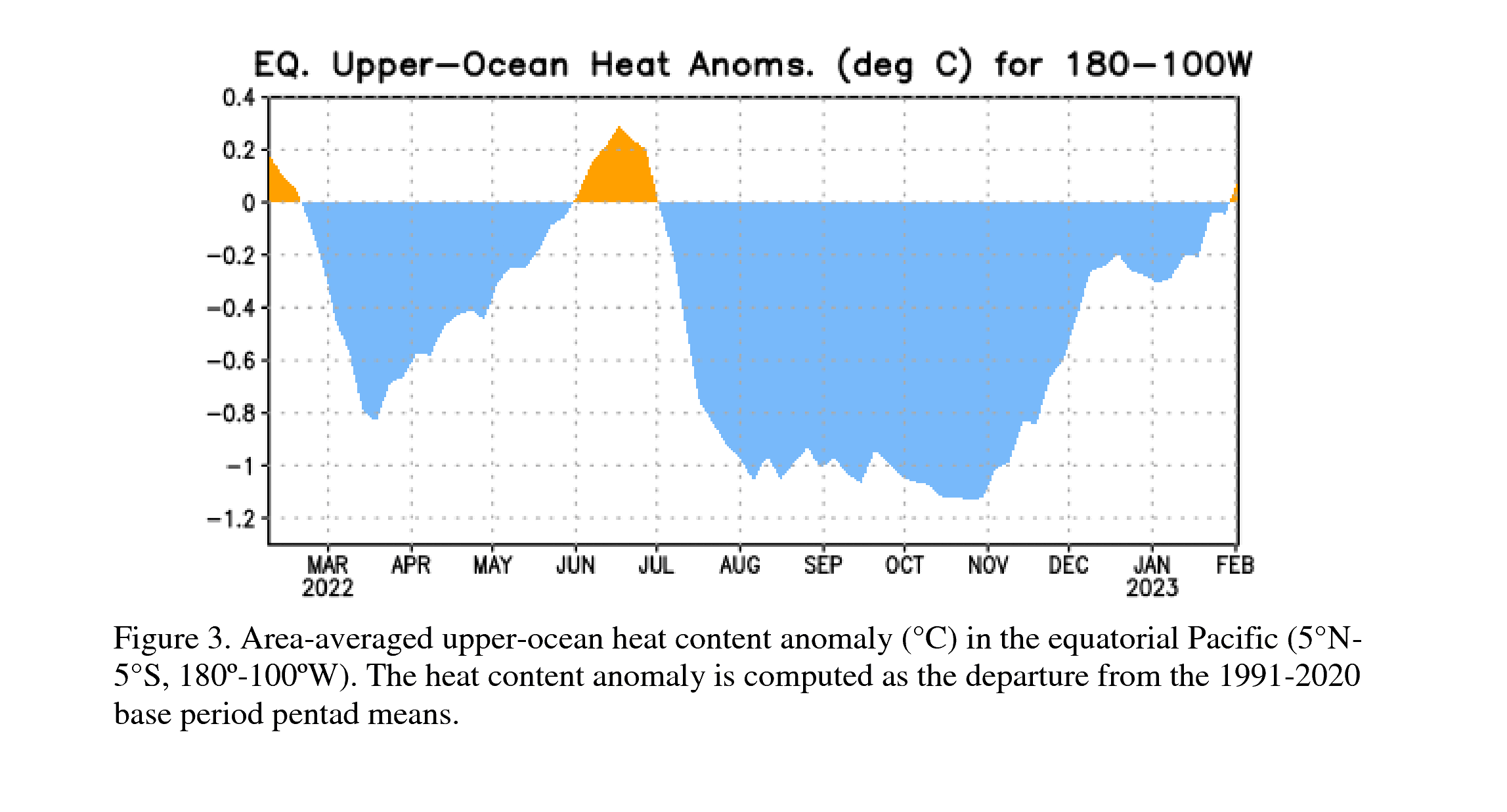
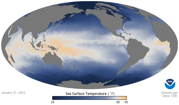
There are increasing chances of El Nino in the long range forecasts, according to the Climate Prediction Center at the National Weather Service. El Nino is a phase of Pacific Ocean water and is associated with the band that develops in the central and east-central equatorial Pacific, including the area off the Pacific coast of South America. Most recently, we've been in a La Nina phase, which is cooler water.

For the west coast, El Nino typically means a drier winter, but a wetter spring, though for California, it may be a combined wet winter and spring. For the east coast, particularly the southeast, winters are generally wetter. The southeast is cooler as well.
Though there is an increasing chance of an El Nino forming, according to the Climate Prediction Center, there is still some uncertainty. Predicting the ocean phases can be quite tricky. The strength and impact of individual El Niño events vary.

The stronger the event, the greater impacts will be. That said, this is why changes in ocean temperatures are monitored closely. It can help in predicting flood and drought events across the U.S.

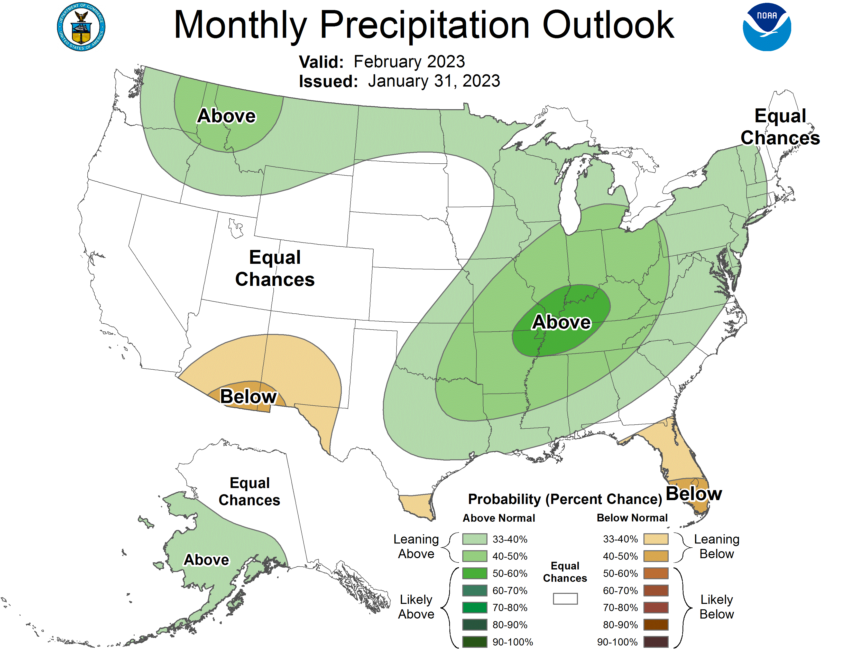
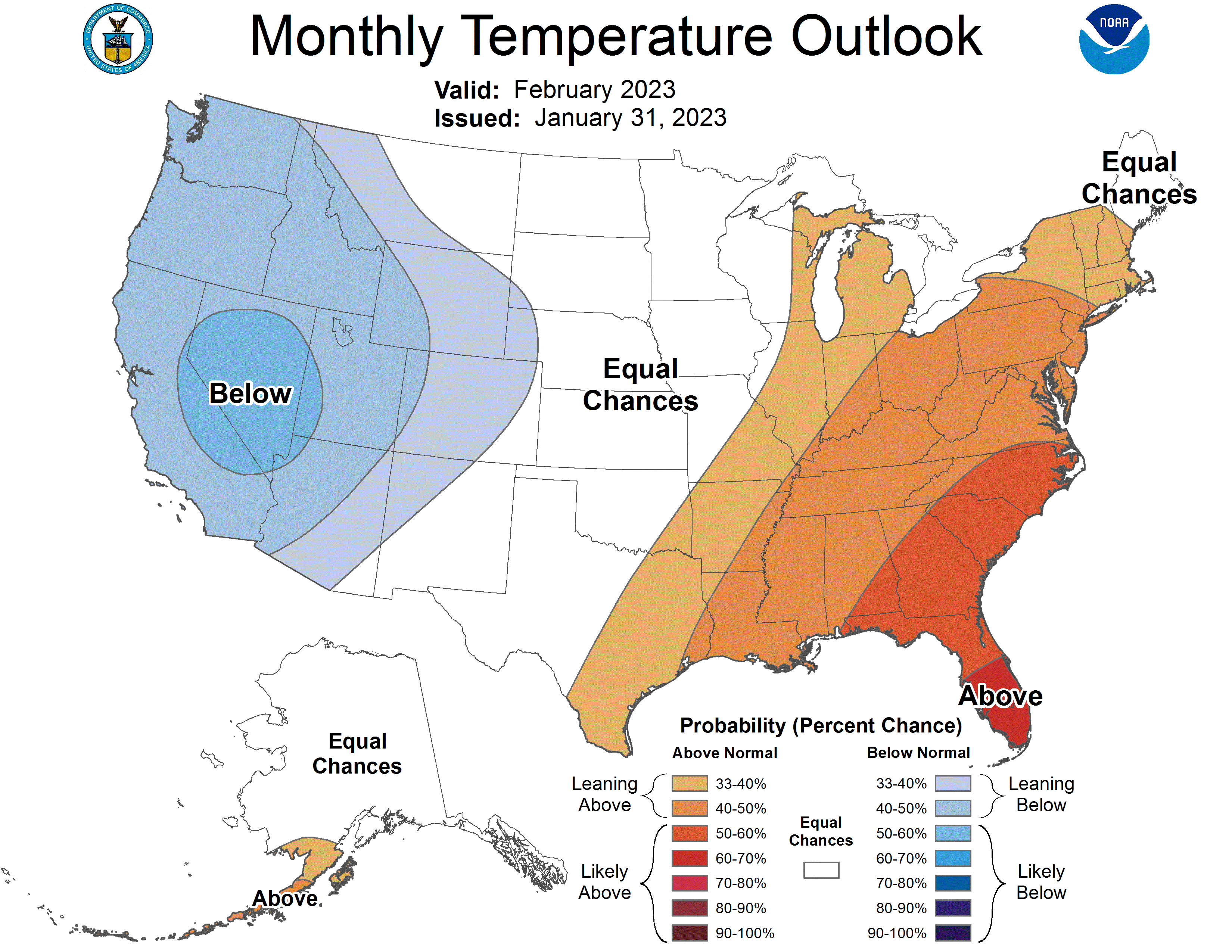
Meanwhile, temperatures over the next month are forecasted to be cooler in the west and warmer in the east. Precipitation will be wetter across the northern tier states and the Midwest and much of the southeast, while drier in much of Florida and parts of Arizona and New Mexico.

If El Nino is to develop this year, it would be a big change from the persistence of La Nina, which has been mostly uninterrupted since the summer of 2020.
